 CalmBeach Greece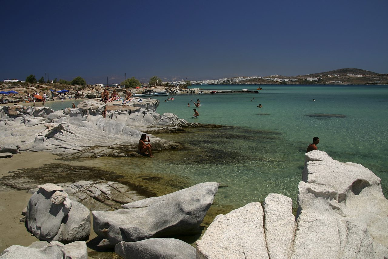
Organized
Organized beaches in Paros
23 organized beaches in Paros: with sunbeds, umbrellas and facilities. Check live wind & waves for each beach on CalmBeach before you go.
- 23beaches
- 23organized
- 10with photos
Prefer sunbeds, umbrellas and a beach bar in Paros? These 23 organized beaches usually have facilities and easier access. Check wind and waves in CalmBeach before you go.
The beaches
-
 Kolympithres
The sculpted granite of Paros — Not a single beach but a string of small sandy coves between huge granite boulders that wind and waves have carved into smooth, rounded shapes…
-
 Farangas
The cove among the rocks — On the south coast, a cluster of beaches: one large sandy beach and two smaller coves, divided by rocky outcrops that reach the sea. The name evokes…
-
Mikri Santa Maria
The small cove next to Santa Maria — Mikri Santa Maria is the smaller cove on the same north-east coast as the big Santa Maria, separated from it by a rocky spit.
-
Santa Maria
The lively watersports beach — A large, fully organised beach on the northeast coast, with shallow clear water and beach bars — one of the liveliest on Paros…
-
 Lolantonis
The bay below Aspro Chorio — Lolantonis is an enclosed bay on south-east Paros, below the settlement of Aspro Chorio, mixing sand, pebbles and rock.
-
 Pounta
The kitesurf spot facing Antiparos — On the southwest coast, facing Antiparos — and the spot where the ferry to that island docks. The narrow channel funnels the Meltemi into a steady…
-
Agia Irini
The palm grove of south-west Paros — Agia Eirini stands out for the palm grove that reaches almost to the water — a rare sight in the Cyclades, where shade usually means tamarisk.
-
Martselo
Ten minutes north of town — Martselo is the next sand along from Parikia, with tamarisks at the back and water that deepens slowly — which is why families fill it.
-
 Livadia (Parikia)
Parikia’s own beach — Livadia is the sand that starts a few minutes’ walk from Parikia harbour — the choice for anyone with an afternoon ferry and no time to go further.
-
Logaras
Across from Piso Livadi — Logaras is the organised sand beside the fishing village of Piso Livadi on eastern Paros: tavernas at the edge of the sand and shallow water in front.
-
Parasporos
Dunes south of Parikia — Parasporos is the first big sand south of Parikia, with low dunes and juniper behind the shore.
-
Chrysi Akti
The Golden Beach of windsurfing — A long, unbroken sweep of golden sand on the southeast coast, with clear water. The reliable Meltemi has made it one of Greece’s top windsurf…
-
Paralia Alyki
The village next to the airport — Aliki is the second-largest seaside village on Paros and sits next to the island’s airport — one of the few Greek beaches where you watch the small…
-

-
Ampelas
A fishing village, not a resort — Ampelas is a small fishing village a few kilometres east of Naoussa, with a little harbour, boats and tavernas that catch their own fish.
-
Dryos
The winter anchorage — Dryos was once a winter refuge for caiques, thanks to its small enclosed inlet — the village grew up around that little harbour.
-
.jpg&width=400)
-

-

-

Photo credits
- Kolympithres: Tango7174, CC BY-SA 4.0
- Farangas: Olaf Tausch, CC BY 3.0
- Lolantonis: Roger Husvik, CC BY 3.0
- Pounta: rene boulay, CC BY-SA 3.0
- Livadia (Parikia): Σουζάνα Ιωακειμίδου, CC BY-SA 4.0
- Krios: Olaf Tausch, CC BY 3.0
- Delfini: Thanas Todhe (Guri Q…, CC BY 3.0
- Paralia Parikias (kentro): Olaf Tausch, CC BY 3.0
- Tserdakia (Nea Chrysi Akti): brunobarbato, CC BY 3.0
- Navtikos omilos Parou: brunobarbato, CC BY 3.0
Good to know
Which beaches in Paros are organized?
The beaches listed here are marked as organized, usually with sunbeds, umbrellas and food or a beach bar nearby. Facilities can change by season, so confirm locally.
Are organized beaches less windy?
Not necessarily. Facilities do not change the wind or waves — check live conditions in the app and compare less exposed beaches on windy days.
When is the sea calmest here?
Across 23 of the beaches on this page, the open water in front of them is typically 0.88 m in June, 1.11 m in July and 1.13 m in August when the meltemi is at its strongest, and 0.99 m in September. June is the calmest month of the season. We calculate these figures ourselves from European Copernicus wave-model data at 4.2 km resolution. They describe the sea offshore, not the shelter of an individual cove — a bay protected by a headland will usually be calmer than this.
How warm is the water, month by month?
Off 23 of the beaches on this page the sea is typically 18.9 °C in May, 22.2 °C in June, 23.7 °C in July, 24.4 °C in August and 23.9 °C in September — ideal at the height of summer, mild in June. By October it is 21.7 °C. August is the warmest month. Satellite measurements, 1995–2024, from a sea cell about 5 km offshore; shallow bays usually run warmer than this.
Wind and waves change every day. See live conditions for any of these beaches before you drive out.
Open the live map →